ISRO-India’s space research organization may routinely be known for its noteworthy stories of lunar missions, and martian explorations, yet numerous lesser-known missions have gone ahead and affecting the daily lives of millions of citizens of the country. Beyond rockets, or satellites, ISRO’s technology has expanded to many areas in agriculture, communication, healthcare, and disaster mitigation, which are all advantageously affecting hundreds of millions of people in India. The public and world around often recognize ISRO for Chandrayaan or Mangalyaan, but there are plenty of projects with tremendous impact through contributions. Some of these remained attributed while others each had value-adds which respectively reflected their impacts directly or indirectly to their objectives and purposes.
One of the missions is the Indian National Satellite system, INSAT, a project that revolutionized the sphere of weather and communication satellites in very significant ways. INSAT, which started in the 1980s, is still a series of satellites for important information about the weather, television broadcast, and emergency messages. Farmers get reliable forecasts of weather conditions, fishermen receive storm alerts, and even remote villages receive television and radio broadcasts through INSAT – these connections, which seems quotidian for us today, were enabled by INSAT to connect rural India long before we were connected to the internet.
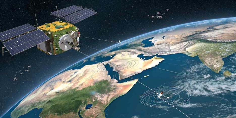
ISRO’s underrated contribution comes from IRS, the Indian Remote Sensing (IRS) satellite system. It was launched to monitor land, water, and environmental resources, but today IRS satellites are a significant part of modern agricultural and urban planning. The IRS system has helped officials, at all levels of government, gather precise data that is now used for everything from mapping irrigation systems to monitoring deforestation so that authorities can make data-driven or data informed decisions and policies for sustainable development. In addition, the IRS system aids farmers with crop monitoring and soil mapping, providing a better understanding of yields to make more informed decisions for water use. The ability to predict droughts and floods has significantly improved because of this mission; saving untold lives and livelihoods.
India’s GSAT series of communication satellites have steadily strengthened the nation’s already strong digital infrastructure. While urban areas enjoy significant high-speed broadband connectivity, it is the GSAT series that is helping to connect rural India to the wider communications ecosystem. The GSAT series supports tele-education, telemedicine, and e-governance services in parts of India where no fiber-optic infrastructure has been built to support internet connectivity. For example, during the COVID-19 pandemic, GSAT-based telemedicine services enabled medically trained personnel located in urban centers to teach healthcare workers in rural communities how to take care of patients by showing them, over live video, how to remotely handle difficult case scenarios. This type of service allowed greater access to healthcare across rural communities, while also showing that space technology can be a lifeline in times of distress.
Like GPS, ISRO’s NavIC navigation system is another area we often think of and the confusion can be explained – NavIC is incredibly more accurate than GPS within India! The Indian Regional Navigation Satellite System, NavIC, has many applications including in disaster management, vehicle tracking, and fishing. It allows fishermen to navigate and understand the dangerous weather and banned areas. In logistics and transportation, NavIC is used for optimized routing and fueled managed, while in areas like defense and aviation, NavIC keeps positioning secure. NavIC has allowed India to become self-reliant in navigation technologies and lessen dependence on foreign navigation systems.
The innovative system such as BHUVAN which is ISRO’s web-based geographic information system, provides satellite imagery and mapping services similar to Google Earth, while being specifically tailored to the Indian context. BHUVAN has been employed for urban design, monitoring water bodies, mapping trees and forests, and even measuring the performance of government schemes. BHUVAN has democratized access to satellite data, and both students and researchers and local governing bodies are now able to visualize real-time environmental and geographic data. This open access initiative further exemplifies ISRO’s commitment to not only innovation but also national public empowerment through technology.
In aggregate, these missions exemplify how ISRO is involved in much more than space exploration; it is really nation-building from the ground up. Each of the satellites and systems have incrementally transformed India into a more connected, informed, and resilient society. As the world watches and marvels at ISRO’s interplanetary accomplishments, the relevant transformation is how this lesser-known form of transformative the missions have touched the everyday lives of billions, demonstrating that the development of space tech is not limited to going to the stars, but also to improving life on the ground.